
Walk a Honolulu County Street
A street-by-street search works best as a chain, not a single query. Honolulu County has no public master list of everyone at each doorway. City assessment data ties a site to a fee owner, while the statewide recorder ties that owner to a land instrument. Maps, permits, election records, and older printed directories each answer narrower questions. Keep the date beside every finding and never turn an owner name into an unproved claim of occupancy.
- Standardize the street number, street name, and unit. Search Real Property Assessment Division records by site address and save the parcel or TMK.
- Open the same place in Maps of Oʻahu. Turn on parcels and address points, then click each lot along the segment.
- Read the parcel result for the fee owner, sales references, class, exemption clues, and site address. Separate the mailing address from the physical site.
- Use the document number or party name in the Bureau of Conveyances index. Compare the deed's TMK and legal description.
- Add DPP permit dates and carefully limited election information. For a dated household, check a volume covered by the Honolulu County city directories.
The result is evidence with different weights. A deed names parties to a transfer. A permit may name an applicant or representative. An assessment lists the fee owner. An old directory records what its publisher gathered for that year. Together, they support a careful address history, but none is a live household roster.
Honolulu County Address Fields
The city's QPublic handoff is the strongest first stop for a modern Honolulu County street directory search. Its basic public screen does not offer owner-name searching. It expects an address or an eight-digit TMK without punctuation. That design makes a known site more useful than a known surname.
| RPAD control | Input | Use on a street | Important limit |
|---|---|---|---|
| Street Number | Numeric text | Targets one site | Combine with street name |
| Street Name | Text | Matches the named road | Omit the street suffix |
| Unit Information | Text | Refines a condominium result | Unit labels vary |
| Parcel/TMK | Eight digits | Reopens an exact parcel | No dashes or colon |
| Owner name | No basic input | Owner appears in details | Not a public search field |
A result can include fee owner, site address, TMK, land area, class, assessments, exemptions, sales, building details, photos, sketches, and map links. Fields vary by property. The RPAD FAQ also explains that deed data arrives from the Bureau of Conveyances and can take time to process, so a fresh recording may not yet appear on the parcel card.
The Honolulu County property search confirms why a street number, street name, unit, or parcel key must come before an owner comparison.
Honolulu County Street Evidence
Several address-keyed systems contribute to the Honolulu County street directory. Their records overlap, but their custodians and meanings differ. The TMK is the best bridge among property, map, permit, survey, and deed work.
| Address record | Keeper | Evidence returned | Ways to reach it |
|---|---|---|---|
| Assessment parcel | RPAD | Fee owner, situs, class, value, sales, exemptions | QPublic, Bethel or Kapolei office, phone |
| Parcel map | HoLIS/DPP | Lot shape, address points, zoning, flood and SMA layers | Web viewer and city GIS portal |
| Recorded instrument | State BOC | Parties, deed, mortgage, lien, release, map and legal description | Online account, Room 123, mail request, phone |
| Survey or plat | DAGS/BOC | Lot, file plan, Land Court map and survey references | Online index and copy request |
| Permit file | DPP | Project, dates, approvals, review and staff fields | Permit index, HNL Build, DAIB request |
| Voter information | County Elections | Approved public status and precinct fields | Own-record portal or purpose-limited office request |
Online access is only part of the chain. RPAD answers questions by phone at 808-768-3799 and serves counters at Bethel Street and Kapolei. BOC takes calls at 808-587-0147, maintains its public reference room, and accepts written searches. DPP's Data Access and Imaging Branch supplies full or older permit files that the index cannot deliver. A narrow Uniform Information Practices Act request can seek a non-indexed public record from the office that keeps it.
Browse Honolulu County in HoLIS
HoLIS turns one known address into a block view. Search an address or TMK, zoom to the street segment, switch on parcel and address-point layers, and click nearby outlines one at a time. Zoning, land use, flood, Special Management Area, roads, districts, facilities, and stormwater layers can add context. They do not identify every person on the block.
The map is especially useful where a building has several address points or a condominium uses CPR digits beyond the base parcel. Record the full identifier displayed by RPAD. A line on the screen is not a legal survey, and the city warns that changing map data should not replace an official boundary document.
The official HoLIS ArcGIS portal organizes the city map and parcel groups used in an address search.
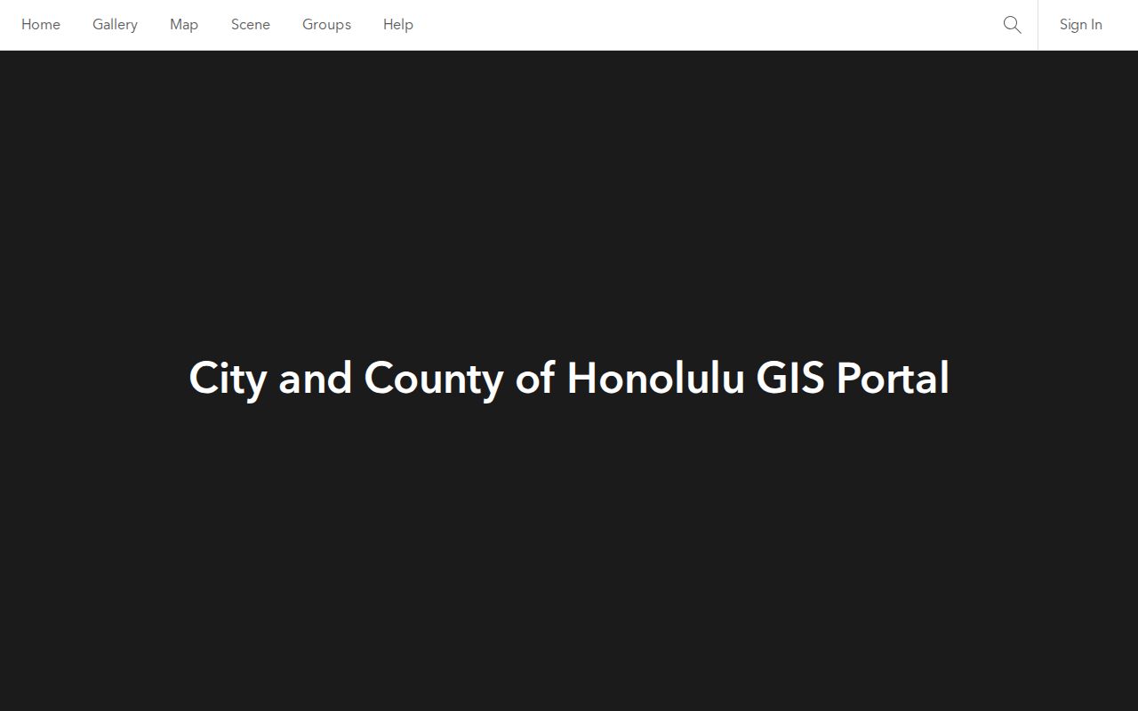
The portal view provides the geographic handoff from a named street to parcel layers and then to an exact TMK.
Honolulu County Address Keys
Oʻahu records use several terms for place. Knowing the difference prevents a street directory result from being overstated.
- Parcel
- A defined piece of land recorded under a tax map key. A building can contain many condominium units tied to added parcel digits.
- Situs address
- The physical site used for parcel, permit, and map searching. It may differ from the address where tax mail is sent.
- Plat
- A recorded or official map that shows lots, blocks, subdivisions, or survey references.
- Criss-cross directory
- An address-first printed directory that may show the listed householder or business for a specific publication year.
The Oʻahu TMK is commonly formatted zone-sector-plat:parcel, with a leading 1 for the island. Search screens often want eight plain digits. A legal description can preserve the lot or file-plan identity even when a postal label, number, or road spelling changes.
Note: Keep the full CPR or ownership-sequence digits shown on a parcel record when a base TMK leads to several units.
Open Honolulu County Deed Links
Hawaiʻi is unusual because one statewide Bureau of Conveyances records land papers for every county. Honolulu County does not have a county recorder with a separate deed site. BOC handles both the Regular System and Land Court, and its online records generally reach back to 1976. A registered account can search without a search charge by grantor or grantee name, document number, and identified TMK routes. Purchased images are separate.
Start from RPAD sales history and copy the document number. Check the recording date, document name, parties, TMK, book and page or modern number, related document, and legal description. A deed transfers an interest. A mortgage, lien, release, or Land Court order serves another role. Instrument codes help separate them. More than 344,000 documents and maps move through BOC each year, so exact identifiers matter.
Online numbering also changes by era. Older material may use Liber, book, and page. Records from 1990 through 2011 use a year plus document number, later years used eight digits, and new documents since August 2024 use ten digits. When the online index ends, Room 123 is open on business days with posted research hours, and BOC offers a written search route. The form asks for parties, type, date, address or TMK, known reference, certification choice, return method, payment, and a stamped return envelope.
Older-record bridge. Call before traveling to Room 123 because staffing and lunch can affect research-room hours.
Map Honolulu County Legal Lots
A street name may change while the legal lot stays traceable. The DAGS Survey Map Search accepts Land Court application, map, and consolidation numbers; file-plan and registered-map numbers; HTS or HSS plat numbers; Hawaiian Home Lands plat numbers; and CSF numbers. Those fields connect a parcel to formal geometry when the web map is not enough.
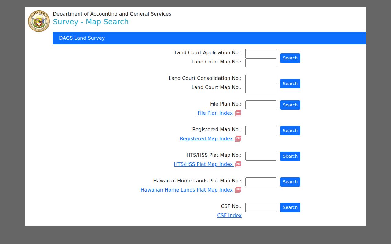
The captured form shows why a saved file-plan or Land Court reference can recover a lot after a simple address search fails.
The research found no official island-wide street-renumbering chronology. Do not invent one. Compare a directory street section, old map, permit address, present USPS form, legal description, and TMK. Search with and without a suffix and with both Hawaiian diacritics and plain ASCII spellings.
Time Honolulu County Street Work
Building permits can date construction, additions, alteration, demolition, and code activity by address or TMK. Honolulu's historical permit screen includes application or permit number, address, TMK, and created, issued, or completed dates. Results can expose Details, Approvals, Plan Reviews, and Staff Assignment tabs, with an Excel export.
The split in access is important. The older public Building Permit Search contains data through July 28, 2025, while newer activity is moving through HNL Build. Records before January 1972 are not in the online run. Full plans and files go through DPP's Data Access and Imaging Branch. A permit applicant may be an architect, builder, owner, or representative, so the name is not proof of residence.
Utility customer lists are not public. An electrical or plumbing permit can date work, but it does not reveal the customer behind a service account.
Honolulu County Voter Boundaries
Election records do not provide an anonymous public street browser. The Online Voter Registration system requires identity fields so a voter can confirm or update that person's own record. Hawaiʻi law makes full name, district or precinct designation, and voter status public, while other affidavit details are restricted except for election or government purposes.
A valid request goes to the Honolulu County Elections Division, states the allowed purpose, and confirms fields, delivery, fees, certification, and protected-voter exclusions. Staff can also provide proof to the voter who supplies identifying facts. Phone, mail, email, in-person service, voter centers, libraries, and paper forms remain access routes. The research did not find a current full-file fee or delivery format, so ask before payment.
That boundary matters. Registration status and precinct are not a household census. Ballot choices are not a public resident field, and protected addresses should not be expected in a released file.
Honolulu County Street Directory Limits
A Honolulu County street directory can show recorded owners, lot geometry, dated sales, permit work, public election fields, and some historical listings. It cannot reliably list all renters, relatives, guests, or other people inside a home. The owner may live elsewhere. Tax mail may go to a trust, estate, agent, or different address. A home exemption shows that a tax claim was made, not the names of a household.
DMV address data and utility subscriber data are not open address books. Confidentiality programs, sealed records, redaction rules, and agency exemptions can remove details from public view. Even a published record may be stale. Confirm a material fact with the custodian and state its date.
Lawful personal use. Use Honolulu County address records for legitimate research, property curiosity, family history, or fraud prevention. Never use them to stalk, harass, threaten, or repeatedly contact anyone.
When no web result exists, follow the documented fallback: RPAD or BOC by phone and counter, BOC by mail, DAIB for permit files, State Archives or library reading rooms for older sources, and a focused UIPA request to the actual keeper. A missing online hit is not proof that no record exists.